Parking
Addeycombe Farm
Ship Crag
Misadventure
Ye Olde Chlorine Dectector
The Chinnels
The Three Wheat Heads Inn
Lady's Bridge
Route Details
18km (3.5 hours)
Map OS Landranger 81
Parking Free
No wife this time,
but instead, with an arguably much more capable companion in my friend Shaun, who was visiting from Newcastle-under-Lyme, we flicked through the guidebook to find one of the longer, more challenging walks – and settled on combining the 12km Carriage Drive and 6km Thropton to Rothbury for an extended circular route that would certainly put me through my paces.
Starting at the 🚗 Cowhaugh car park,
which is free except overnight and always has space, the beginning of the route was familiar from previous walks in the area. I was sad to see there was no Ice Cream van in the car park this time, but I guess the middle of September is out of season for 🍦 Mr Whippy.

The starting line
After getting confused by the initial route description in the guidebook, I used Google Maps and satellite views to find where we were meant to begin.
With Shaun already doubting my navigational ability, we immediately hit the incline along a public path up towards Hillside Road.
Already having to stop at the summit for a breather, I began to wonder if my sedentary lifestyle was beginning to catch up with me – but on we marched to not look weak in front of my 6ft 3, 11 Stone friend who was full of energy and keen to pick up the pace.
Speeding up as requested, I got my head stuck in Google Maps and the guidebook as we headed up towards 📍Addycombe Farm. Still confident, even when the track changed, we got to the private property sign before realising I’d missed the turning.

I’m sure that sign wasn’t there a moment ago

Heading up with Shaun and Sheep

GTFO Geese
Backtracking a couple of minutes, we found the gate with a clear ‘public footpath this way’ sign mocking me as my friend wondered if he’d made an error in judgment in letting me drive him 90 minutes from my place to attempt 18KM.
When on the correct field, we slowly ascended, cutting a diagonal through it, guided by the friendly sheep pictured above.
As we approached the edge of the field, we encountered the farmer, and I checked with him that we were still on the public footpath before quickly being spotted by a pack of extremely territorial geese. 🪿
Realising quickly that we weren’t welcome, we scampered to the top of the hill, where I again consulted the guidebook for directions. Confident I’d understood them, we then agonizingly descended the same amount we’d just climbed, only to find ourselves on the B6341 – Which was not correct…

Make a U turn when possible
Alas, It was time to go straight back up the hill… passing it off as completing the trail on hard mode and ‘think of the extra calories we will burn.’ Once back at the summit, I double-checked everything, and we headed back on the correct Carriage Drive path in a Westerly direction.
Along the way, we clambered the recently felled area of trees to get a good vantage point for pictures despite the weather’s impact on visibility. Luckily, Rachael was not with us, or this crazy daredevil idea would not have been permitted.

Back on the Carriage Drive!

Rain, Fog and Deforestation

Ship Crag – I think
Celebrating the successful clambering without injury, I grabbed a Brioche Pasquier (choco bread to council estate-raised people like me), and Shaun had a banana. Moments later, behind me came a hurl of expletives. I turned to find only a 🍌 banana skin pinched between Shaun’s fingers, and a large, sad-looking fruit laid out on the wet, dirty path. In anger, Shaun added nutrients to the surrounding trees and vegetation by furiously flinging his biodegradable brunch into the tree line.
Hitting the 25% mark and bringing the swear to count down a touch, we found the boulders left by the receding ice cap millennia ago mentioned in the guidebook—the larger one of which is named Ship Crag—before coming across more modern but still ancient by human standards, rocks carved with what might be the fanciest and longest-lasting graffiti I’ve seen.

I was ‘ere 150+ years ago. IDST

See you in a few hours Rothbury

No Man’s Sky
From the graffiti covered vantage point, our walk turned 90 degrees away from Rothbury and north along the final section of Carriage Drive towards South Cartington. This expanse immediately reminded Shaun and me of a ‘No Man’s Sky’ style procedurally generated planet ripe for harvesting base-building resources.

I shall call him – Sir Ramalot
On this large red chippings track, sandwiched by fields of thick heather and cliff edges, there are more livestock, power lines, and even a television mast.
After consulting the guidebook, it was time for my navigation abilities to fail me yet again. It instructed us to go off the beaten path, following yellow waymarkers through open access land, to the dry stone wall and ‘dropping down through the forest.’
After finding two of the three markers, we hit a very overgrown area, which must have been hiding the normal route into the forest tracks.
Unwilling to backtrack again, we followed the edge of a barb-wired dry stone wall and across hidden streams of water underfoot. Unfortunately, Shaun misjudged on one occasion and turned his black shoes to brown – much to my amusement.
Eventually, we bit the bullet and found a safe way to hop the barbed fence into the forest and backtracked to the main path, which confirmed my suspicions that overgrowth had obscured the correct entry into the forest, which redeemed my credibility a little, but not much.

Moments before misadventure

Back on solid ground

Ye Olde Chlorine Detector
Exiting the forest down a narrow but otherwise standard track and road, we came across a disused chlorine detector that appeared to be ‘installation number 0012’ from Northumbrian Water Ltd. Given its serial number and incorporation date of 1989, this building is likely over 100 years old!
Past the halfway point, we passed fields of cattle and horses, with one field in the distance hosting an ominous swarm of birds looking like a modern video game objective waymarker. Deciding there was no XP to be earned by deviating from our already long trail – we kept grinding.
At the end of the track, opposite the 📍Black Chirnells, I spotted a sign to Netherton and Shitter , which was hilarious to me, thinking that a place hundreds of years ago might have genuinely been named that. I’d later realise it was merely convincing graffiti on a sign directing to the township of Snitter.

Tee hee hee, SnShitter
With Thropton firmly within our grasp and the prospect of a sit-down and food – our pace quickened – passing more livestock and farm vehicles to remind us that while we were out of the thick heather and forest, we were still in the sticks.

Wonder if he could play for Sedgey

Back Burn Bridge

Should have had the carvery!
Pulling into Thropton itself, we crossed the Back Burn Bridge, which Shaun decided to test its structural integrity by jumping up and down on it like we wanted to fall 30 feet into a solid riverbed. Thankfully, the footbridge held firm, and we arrived at the 📍Three Wheat Heads Inn, which thankfully managed to squeeze us in without a reservation.

Are you sure about that?
After having my fill of Cumberland sausage and mash and being jealous of Shaun’s ‘Five Slice Carvery,’ which I should have totally gone for instead – we set out on the final third.
Shortly before the footbridge, I spotted something I often find on walks – a randomly placed painted rock – This one told me it was my lucky day – which is funny – because crossing the bridge moments later, we were met with a field laden with sheep crap that I stepped in several times – Muck for luck I guess.

Foot Bridge to Good Fortune

Easy going fields

Turn back before Tosson
With the trail on the final stretch, things got less varied and more uniform—following fairly well-worn tracks through fields and roads leading back toward Rothbury. This time, for once, I read the sign correctly to take us down the right path without accidentally ending up in 📍Great Tosson, a village over.


After one final navigational misjudgment after crossing Lady’s Bridge, we ended up back on the same incorrect road from the beginning of the day. We did a quick double back to the public footpath that runs adjacent to the road and River Coquet.
With the end in sight, we strolled past the beautiful Rothbury House retirement home, which has a residents’ garden overlooking the water, and arrived at the playpark near the car, clocking in at just over 3.5 hours for a final pace of 11.6 minutes per kilometre. Bosh.
Comments
More Walks
Alnwick Tour
We decided to kill two birds and chalk off the Alnwick Tour during our child-free weekend.
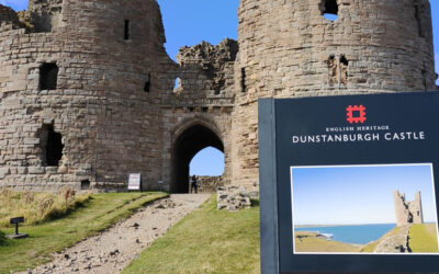
Dunstanburgh Castle Trail
In a rare child-free week, we decided to tackle one of the more distant and dangerous walks on the list: Dunstanburgh Castle.
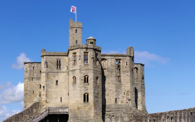
Warkworth Castle
We needed a short walk for Rachael. It just so happens that Warkworth Castle is one of the shortest routes in our guidebook!
Attractions
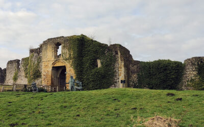
Helmsley Castle
Making the most of the emerging sunshine, we ventured an hour’s drive to Helmsley in North Yorkshire to visit its historic castle and medieval fortress.
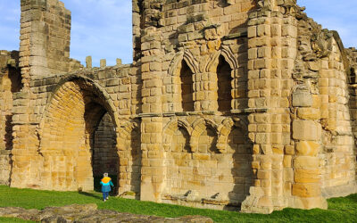
Tynemouth Priory and Castle
On a bright but chilly day, we visited Tynemouth Priory and Castle, a historic site on England’s North East coast.
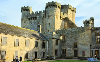
Belsay Hall
On a rare sunny but cold Autumn Sunday, we head to one on our hit list – Belsay Hall, Castle and Gardens in Northumberland.
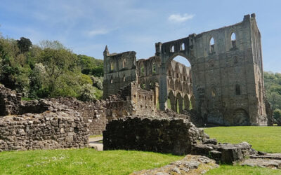
Rievaulx Abbey
After deciding to use Tesco clubcard vouchers to 3x value on an English Heritage membership – we headed out to Rievaulx Abbey.
0 Comments